Just what is this El Niño that we read so much about?

|
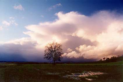
During the winter months El Niño was the runner-up to Newt Gingrich for media attention. El Niño was the whipping-boy for all sorts of weather ills -- flooding in California, hurricanes in Hawaii and Tahiti and decreased salmon runs in the Northwest, to mention a few. Just what is this El Niño we read so much about? El Niño, "The Christ Child", is a local name given to an anomaly in the normal weather pattern found off the coast of northern Peru, occurring in late December and lasting a month or so. This anomaly takes the form of an intrusion of warm ocean waters, replacing normal cold waters. The frequency averages about one El Niño event each four years. In severe El Niños, the warm water intrusion can last up to six months and have disastrous consequences -- torrential rains in the Ecuadorian upland and the Peruvian coastal desert turning into lakes and blooms, economic disaster to fishermen who see the anchovy disappear, and drought in northeast Brazil. The effect is far more widespread. Warming of the ocean surface waters is felt along the West Coast of the United States, disrupting normal patterns of fish habitat, and there is abnormally high rainfall in the southeast portion of the states. In the norm, northwest winds blowing along the U.S. West Coast, and southeast winds blowing along the coast of Argentina and Peru are thrust away from the continental shelves by the action of the earth-rotational Corioli's Force. Compensatory flow from the depths brings cold, nutrient-rich water to the surface. The presence of food in the form of phytoplankton and zooplankton supports higher forms of fish life, some of which is harvested and supports the living of fishermen and families. (The vast majority of fish caught in the ocean comes from the cold water zones adjacent to the continents). When the northwest, and southeast, winds weaken or cease to blow, the upwelling cold waters are replaced by warm nutrient-poor water that cannot support marine life, so the fish migrate to find food for survival. One of the first scientists to attempt to understand this phenomenon was Englishman Sir Gilbert Walker who, in the 1920's was assigned to go to India to study the variations in the Southwest Monsoon. When the monsoon failed, agriculture failed and famine followed; so this was a topic of importance. In the Pacific Basin of the southern hemisphere Walker identified two stations that had 100 years of records: Darwin, Australia and Tahiti (18 degrees south, 150 degrees west). Study of these records revealed a significant correlation. When the average pressure of one was abnormally high, the pressure of the other was abnormally low -- a "see-saw" effect. Thus came the term Southern Oscillation (SO). High pressure at Tahiti was also correlated to strong easterly trade winds extending all the way across the basin, and strong upwelling along the west coast. These winds dragged surface water with them, piling it up at the west end of the basin and leaving it a couple feet below normal in the east end. Surface equatorial water temperatures were low, resulting in small cloud activity from immense cumulonimbus clouds. Noted meteorologist Jacob Bjerkness, in the 1960s saw a correlation between movement of pools of warm ocean water and regions of heavy rainfall, and the SO. When the pressure dropped at Tahiti, and rose in Darwin, the trade winds weakened, warm weather that piled up at the west end of the basin returned eastward to the central Pacific in a slushing motion, as it were. West winds blew out of the west end of the basin and torrential rains fell on the island groups of the central Pacific. A personal note: Canton Island is a coral atoll within the Phoenix Island group, just south of the equator and near the date line. It was used by PanAm as a base for its South Pacific operation. The normal winds were easterly trades. On one occasion there was a delay because of a South Pacific hurricane menacing the route to Suva. I was the flight meteorologist. The year was 1940. I recall standing in the operations building watching the anemometer read 60 knots with the wind blowing from the WEST. Little did I realize this was a manifestation of a strong El Niño event. At a time of Darwin high pressure, sinking and warming air over the continent produces widespread lack of rain-bearing clouds. Drought affected Australia and Indonesia, with its consequent negative impact on agriculture ENSO is not just a local event. The "see-saw", wave effect of pressure extends around the globe. The period 1982-83 was a severe El Niño, equivalent to 8.0 on the Richter earthquake intensity scale. It racked up 8 billion dollars of economic costs. Losses from flooding in various countries were: Bolivia, $300 million; Peru, $650 million; Cuba, $170 million; and the U.S. Gulf States $1,270 million. Hurricane losses were $50 million in Tahiti and $230 million in Hawaii. Drought damages throughout the world included: South Africa, $1,000 million; southern India, $150 million; Philippines, $450 million; Indonesia, $500 million; Australia $2,500 million; western Bolivia $240 million; and Mexico, $600 million. The total: $8,110,000,000! The 1994-95 El Niño also is a severe event with economic totals yet to be added up. If the onset of an ENSO event is marked by a weakening of the Equatorial Trade Wind easterlies, what brings this about? Since these winds are the result of the warm high pressure systems that center in the 30-40 degree latitudes of the North and South Pacific, the question becomes what causes a weakening of these highs? To this question there are no simple, clear-cut answers. The ENSO phenomenon reinforces the reality of the coupling of atmosphere and ocean, each affecting the state of the other -- in a bizarre sense like Siamese twins, one of whom weighs 300 pounds and the other 75. The intricacies of this coupling are only beginning to be understood, but there has been substantial progress made in the past decade of intensive study. When this coupling is fully known it will be possible to develop models of behavior from which reasonably accurate long range forecasts can be obtained. This will enable long range planning to accommodate human response to forthcoming weather extremes of flood and drought, including appropriate agricultural practices, to the end of alleviating human suffering and misery. |
![]() Words
on the Weather Articles:
Words
on the Weather Articles:
London Fog | Weather's Ups and Downs | Yin/Yang of Weather | Clouds from Prison
Under-the-Weather Man | Weather and Literature | For Spacious Skies | El Niño | Summer Solstice
![]()
![]()
All Rights © Copyright John A. Day, 1998 - 2007
Site Design by DoubleRich Design
Last updated on: